Next-Generation Geospatial Analytics for Nature-Based Assets Projects

Visualize, measure, and monitor nature-based assets projects impacts with automated earth observation data and intuitive AI. No GIS expertise required.

CHALLENGES

Where the Market Struggles

EXPERTISE

Resource-Heavy
Geospatial Data Reliance

Expertise

The process typically demands specialized GIS expertise and technical know-how, which can be expensive and largely inaccessible to most users or organizations

Data Sourcing

Dispersed, siloed data slows down mapping and analysis by making it time-consuming to gather and combine information from multiple, unconnected systems

COMMUNICATION

Communication
Effectiveness Gap

Formats

Lengthy, dense documentation (1,000+ pages) or generic brochures and PowerPoints fail to entice capital for critical climate impact

Positioning

In a highly competitive market, project developers and intermediaries need to stand out by effectively communicating project impact

SOLUTIONS

Rethinking the Approach

Data-Rich Maps

High-resolution, layered maps that turn satellite, sensor, and registry data into a visual picture of your project - from vegetation and land use to biodiversity and carbon stocks - all in one interactive view.

Geospatial AI Chatbot

Ask questions of your project in plain language and get answers grounded in real geospatial data. Our geo-trained chatbot pulls from maps, monitoring datasets, and project documentation.

Modular Dashboards

Live, modular dashboards that surface the metrics you and your investors actually care about - carbon impact, biodiversity indicators, project health - updated automatically as new earth-observation data comes in.

Automated Reporting

Verifier-ready, methodology-aligned reports generated automatically from your project data, replacing weeks of manual document preparation with reports produced in minutes and refreshed continuously.

Data Rich Maps

High-resolution, layered maps that turn satellite, sensor, and registry data into a visual picture of your project - from vegetation and land use to biodiversity and carbon stocks - all in one interactive view.

Geospatial AI Chatbot

Ask questions of your project in plain language and get answers grounded in real geospatial data. Our geo-trained chatbot pulls from maps, monitoring datasets, and project documentation.

Modular Dashboards

Live, modular dashboards that surface the metrics you and your investors actually care about - carbon impact, biodiversity indicators, project health - updated automatically as new earth-observation data comes in.

Automated Reporting

Verifier-ready, methodology-aligned reports generated automatically from your project data, replacing weeks of manual document preparation with reports produced in minutes and refreshed continuously.

Dynamic Baselines

Generate project baselines that update as new earth-observation data arrives, replacing static, one-time reference points with a living, defensible view of what "business-as-usual" actually looks like.

Impact Microsites

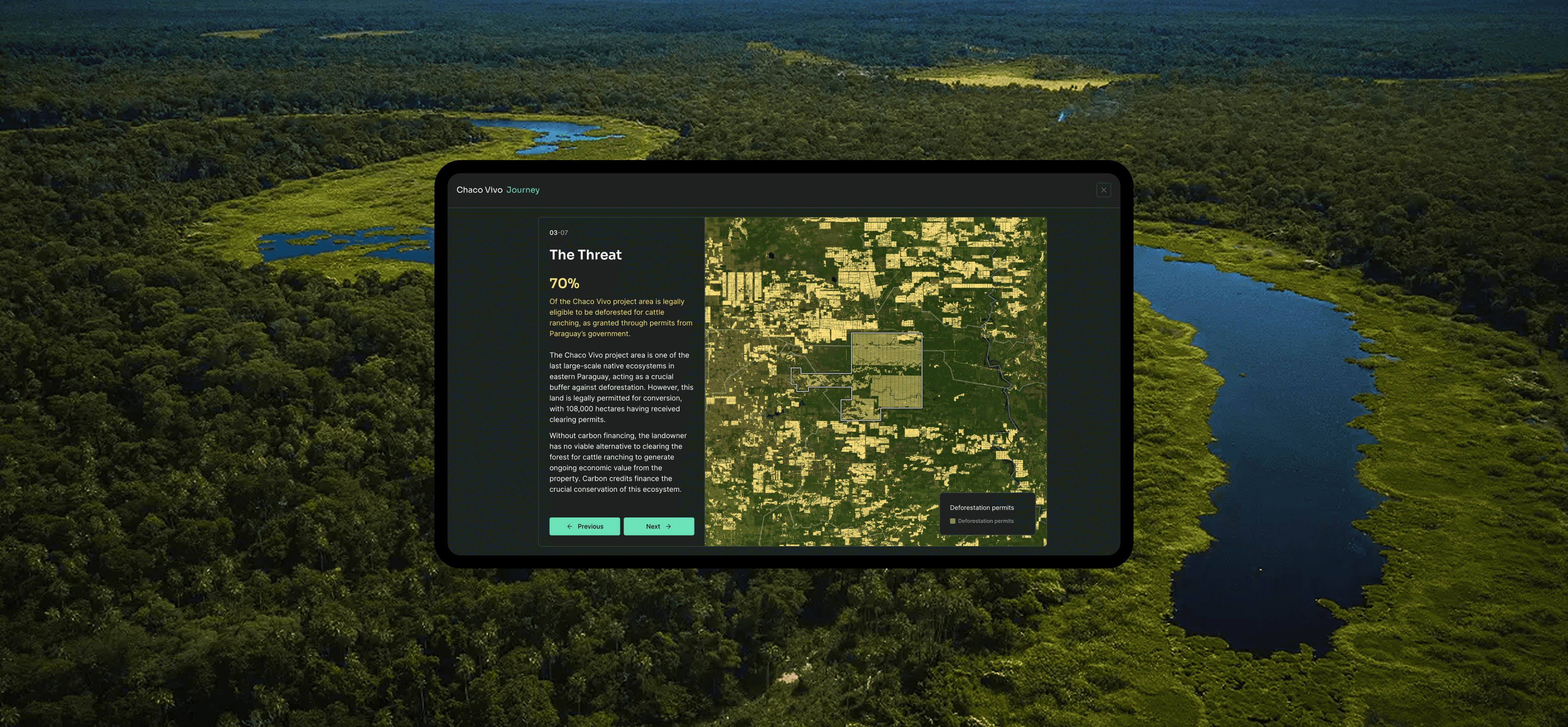
Interactive, on-brand storylines that walk investors, buyers, and regulators through a project's impact - from site conditions to outcomes - turning technical monitoring data into a compelling, guided experience.

Dynamic Baselines

Generate project baselines that update as new earth-observation data arrives, replacing static, one-time reference points with a living, defensible view of what "business-as-usual" actually looks like.

Impact Microsites

Interactive, on-brand storylines that walk investors, buyers, and regulators through a project's impact - from site conditions to outcomes - turning technical monitoring data into a compelling, guided experience.

BENEFITS

Proven Value-Add Benefits

Scalable environmental intelligence for carbon project developers and intermediaries.

INTERNAL

Powerful Geospatial Analysis, Fraction of the Cost

One-Stop-Shop

Expansive suite of aggregated open-source and commercial geospatial datasets, 100+ automated data pipelines, deliver accurate insights in minutes

Cost Savings

Our platform automates the heavy lifting of geospatial analysis, at a fraction of the cost of industry averages (starting at EUR 5,000/AOI vs. EUR 15,000+)

Accessibility

Our geo-trained chatbot and automated charting and interpretation make environmental intelligence accessible and impactful - no prior expertise required

EXTERNAL

Storytelling That Sells Your Project

Accelerate Sales with Better Storytelling

Boost marketing efforts via best-in-class visualization, taking the obscurity out of sales conversations to fast-track financing

Increase Value Through Clarity

Unlock higher price premiums by enhancing stakeholder understanding of your project’s value and building greater trust through clear communication

Your Brand, Fully Integrated

White-labelling services match your branding one-for-one and seamlessly integrate bespoke communication assets and data-rooms into your existing website

INTERNAL

Powerful Geospatial Analysis, Fraction of the Cost

One-Stop-Shop

Expansive suite of aggregated open-source and commercial geospatial datasets, 100+ automated data pipelines, deliver accurate insights in minutes

Cost Savings

Our platform automates the heavy lifting of geospatial analysis, at a fraction of the cost of industry averages (starting at EUR 5,000/AOI vs. EUR 15,000+)

Accessibility

Our geo-trained chatbot and automated charting and interpretation make environmental intelligence accessible and impactful - no prior expertise required

EXTERNAL

Storytelling That Sells Your Project

Accelerate Sales with Better Storytelling

Boost marketing efforts via best-in-class visualization, taking the obscurity out of sales conversations to fast-track financing

Increase Value Through Clarity

Unlock higher price premiums by enhancing stakeholder understanding of your project’s value and building greater trust through clear communication

Your Brand, Fully Integrated

White-labelling services match your branding one-for-one and seamlessly integrate bespoke communication assets and data-rooms into your existing website

Ready to turn earth-observation data into decision-ready impact?

Ready to turn earth-observation data into decision-ready impact?