Building the data infrastructure for real-world assets
Our mission is to help teams working across various industries find, understand, communicate and make effective decisions with complex data.
Trusted by


HOW IT WORKS
Four steps to unlock bespoke
data insights
STEP 1
Enter project details
STEP 2
Upload project area
STEP 3
Upload project documentation
STEP 4
Customise data catalogue
STEP 1
Enter project details
Provide your project name, location and access settings.
STEP 2
Upload project area
Upload a geospatial file defining your project area.
STEP 3
Upload project documentation
Upload supporting documents to describe your project.
STEP 4
Customise data catalogue
Select and/or upload data and organise it into custom categories.
STEP 1
Enter project details
Provide your project name, location and access settings.
STEP 2
Upload project area
Upload a geospatial file defining your project area.
STEP 3
Upload project documentation
Upload supporting documents to describe your project.
STEP 4
Customise data catalogue
Select and/or upload data and organise it into custom categories.
CAPABILITIES
Multiple capabilities in one platform
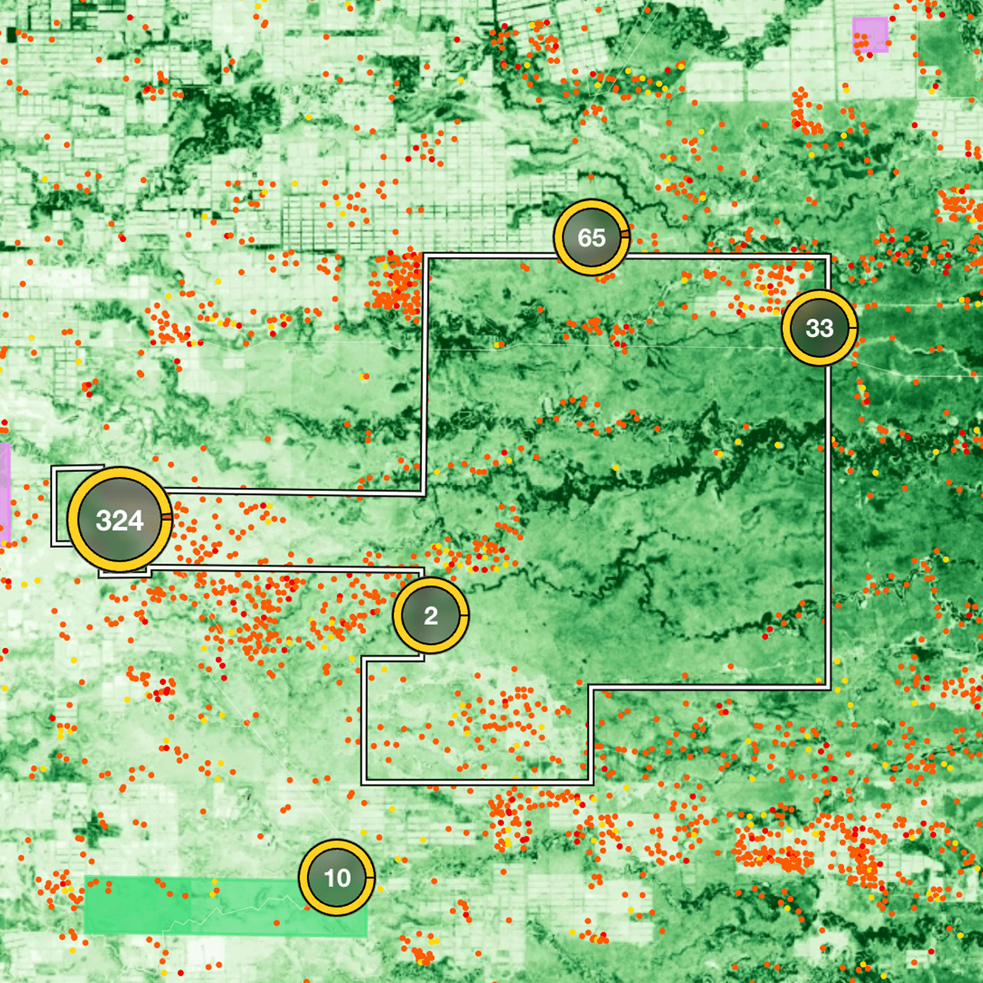
Interactive data map

Analytics dashboard

Dynamic baselines

AI chatbot
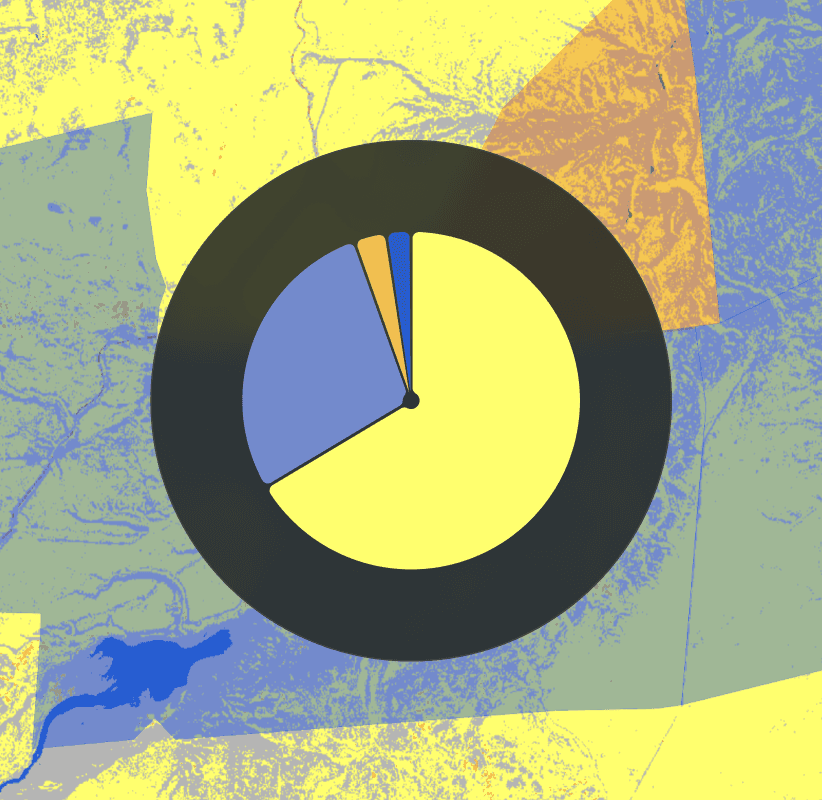
Geospatial analytics

Climate risk
Dynamic baselines

Automated reports

Custom branding

Impact microsites
Custom analytics
Climate risk
Impact microsites
Consulting Services
USE CASES
One unified platform unlocks value across real-asset workflows
Nature
Visualize, measure, and monitor environmental impacts with automated earth observation data and geospatial AI.
WHAT WE OFFER
Data-Rich Maps
Modular Dashboards
Geospatial AI Chatbot
Automated Reporting
Impact Microsites
White Labelling
WHO CAN USE IT
Carbon Project Developers
Credit Buyers
Investors
Conservation NGOs

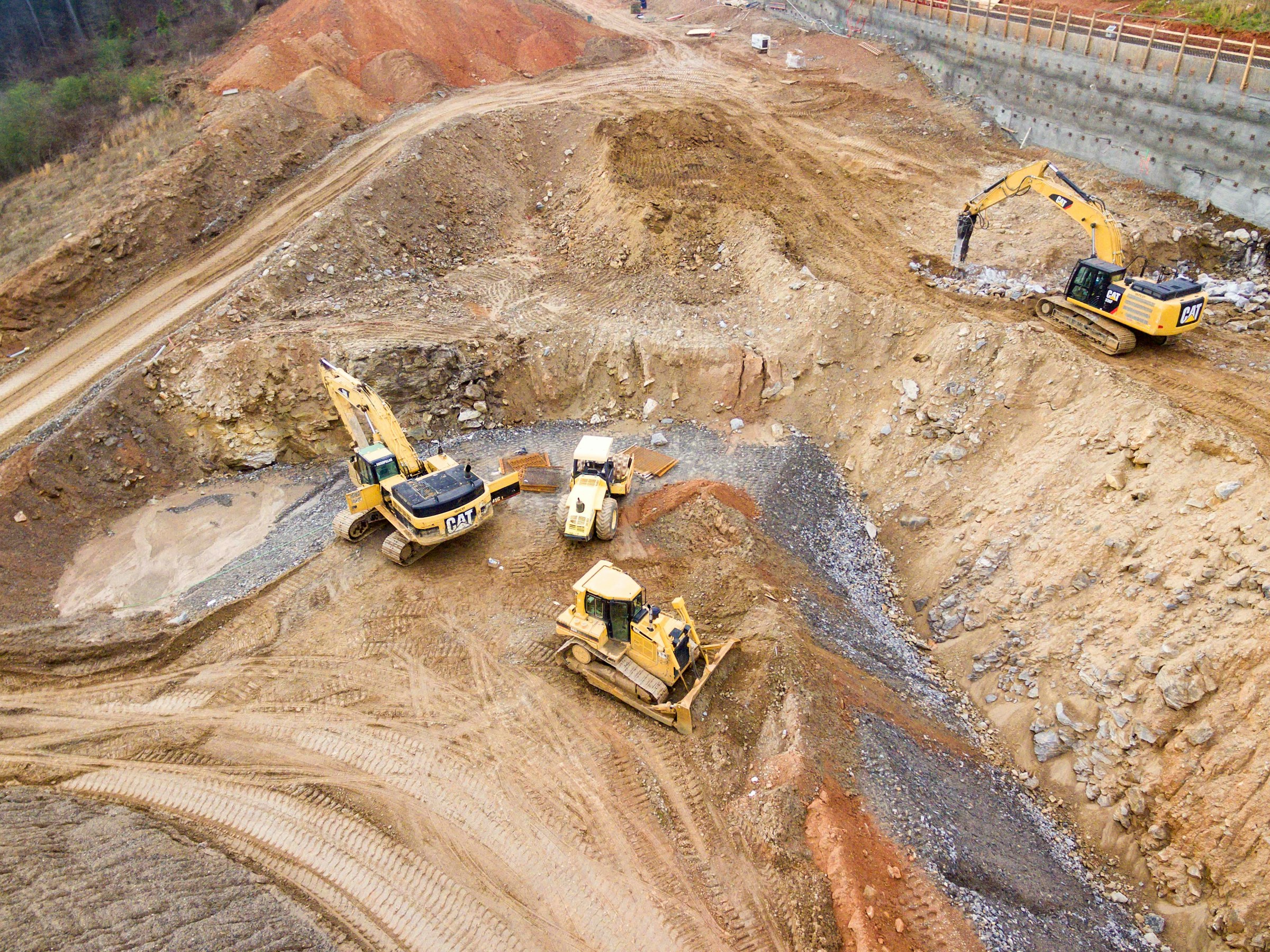


Construction
Fuse terrain, imagery, and site plans into a single optimisation model to find the plateau, ramp, and slope design that minimises excavation and accelerates the planning cycle.
WHAT WE OFFER
Geospatial Site Modelling
Scenario Optimization
Scenario Comparison
Cut-to-BGF Benchmarking
Execution Package
WHO CAN USE IT
Industrial Developers
Civil Engineering Contractors
Geotechnical Consultants
Climate risk
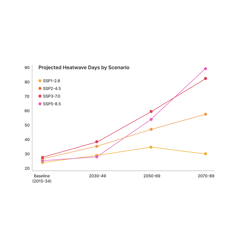
Climate risk is a financial risk. We turn complex heat, drought, flood, and wind data into asset-level assessments so you can adapt, disclose and invest with confidence.
WHAT WE OFFER
Risk Assessments
Multi-Hazard Coverage
Integrated Multi-Source Data
Visual Risk Storytelling
Stakeholder-Ready Outputs
WHO CAN USE IT
Asset Owners & Developers
Investors & Lenders
Public Institutions




Procurement
Lower procurement costs and reach decision-ready supplier shortlists in days, not quarters - by replacing one-off sourcing cycles with continuous, AI-driven discovery and outreach.
WHAT WE OFFER
Suppliers Mapping
Automated Outreach
AI Response Classification
Decision-Ready Shortlists
Auditable Sourcing Trail
WHO CAN USE IT
Industrial Buyers
Procurement Managers
Supply Chain Operators
Nature
Visualize, measure, and monitor environmental impacts with automated earth observation data and geospatial AI.
WHAT WE OFFER
Data-Rich Maps
Modular Dashboards
Geospatial AI Chatbot
Automated Reporting
Impact Microsites
White Labelling
WHO CAN USE IT
Carbon Project Developers
Credit Buyers
Investors
Conservation NGOs
Construction
Fuse terrain, imagery, and site plans into a single optimisation model to find the plateau, ramp, and slope design that minimises excavation and accelerates the planning cycle.
WHAT WE OFFER
Geospatial Site Modelling
Scenario Optimization
Scenario Comparison
Cut-to-BGF Benchmarking
Execution Package
WHO CAN USE IT
Industrial Developers
Civil Engineering Contractors
Geotechnical Consultants
Climate risk
Climate risk is a financial risk. We turn complex heat, drought, flood, and wind data into asset-level assessments so you can adapt, disclose and invest with confidence.
WHAT WE OFFER
Risk Assessments
Multi-Hazard Coverage
Integrated Multi-Source Data
Visual Risk Storytelling
Stakeholder-Ready Outputs
WHO CAN USE IT
Asset Owners & Developers
Investors & Lenders
Public Institutions
Procurement
Lower procurement costs and reach decision-ready supplier shortlists in days, not quarters - by replacing one-off sourcing cycles with continuous, AI-driven discovery and outreach.
WHAT WE OFFER
Suppliers Mapping
Automated Outreach
AI Response Classification
Decision-Ready Shortlists
Auditable Sourcing Trail
WHO CAN USE IT
Industrial Buyers
Procurement Managers
Supply Chain Operators
Construction
Fuse terrain, imagery, and site plans into a single optimisation model to find the plateau, ramp, and slope design that minimises excavation and accelerates the planning cycle.
WHAT WE OFFER
Geospatial site modelling
Scenario comparison
Constraint-driven optimisation
Cut-to-BGF benchmarking
Decision-Ready handoff package
WHO CAN USE IT
Logistics & industrial developers
Civil Engineering & earthworks contractors
Architects & Geotechnical consultants
Climate risk
Climate risk is a financial risk. We turn complex heat, drought, flood, and wind data into asset-level assessments so you can adapt, disclose and invest with confidence.
WHAT WE OFFER
Rapid AI-Driven Risk Assessments
Multi-Hazard Coverage
Integrated Multi-Source Data
Visual Risk Storytelling
Investor & Stakeholder-Ready Outputs
WHO CAN USE IT
Asset Owners & Developers
Investors & Lenders
Public Institutions & Regulators
Procurement
Lower procurement costs and reach decision-ready supplier shortlists in days, not quarters - by replacing one-off sourcing cycles with continuous, AI-driven discovery and outreach.
WHAT WE OFFER
Supplier universe mapping
Automated outreach
AI response classification
Decision-ready shortlists
Auditable sourcing trail
WHO CAN USE IT
Industrial buyers
Procurement managers
Supply chain operators
Nature
Visualize, measure, and monitor carbon project impacts with automated earth observation data and geospatial AI.
WHAT WE OFFER
Data Rich Maps
Modular Dashboards
Geospatial AI Chatbot
Automated Reports
Impact Journeys
Data Rich Maps
WHO CAN USE IT
Carbon Project Developers
Credit Buyers
Investors
Data Rich Maps
Construction
Evaluate trade-offs, reduce uncertainty, and make faster, better-informed decisions across the construction project lifecycle with advanced AI models and intuitive visualizations.
WHAT WE OFFER
Data Rich Maps
Modular Dashboards
Automated Reports
Data Rich Maps
WHO CAN USE IT
Carbon Project Developers
Credit Buyers
Data Rich Maps
Climate risk
Our platform transforms complex climate data into actionable climate risk assessments so you can make adapt with confidence.
WHAT WE OFFER
Data Rich Maps
Modular Dashboards
Automated Reports
Data Rich Maps
WHO CAN USE IT
Carbon Project Developers
Credit Buyers
Data Rich Maps
Procurement
Visualize, measure, and monitor carbon project impacts with automated earth observation data and geospatial AI.
WHAT WE OFFER
Data Rich Maps
Modular Dashboards
Automated Reports
Data Rich Maps
WHO CAN USE IT
Carbon Project Developers
Credit Buyers
Data Rich Maps
Don’t see your industry listed?
Don’t see your industry listed?
Every business has its own set of challenges, and we love figuring out how our services translate to new spaces. Reach out and let's explore what we can build together.
“TransparenC helped us communicate our conservation work to diverse audiences in an interactive way and adapted their platform to our specific needs, becoming a key tool for environmental education."

Utopía del Sur
An ecosystem that creates, promotes, and develops cultural and natural reserves in South America
1/3
“TransparenC helped us communicate our conservation work to diverse audiences in an interactive way and adapted their platform to our specific needs, becoming a key tool for environmental education."
Utopía del Sur
An ecosystem that creates, promotes, and develops cultural and natural reserves in South America
1/3
CAPABILITIES
Multiple capabilities in one platform
Interactive data map
Analytics dashboard
AI chatbot
Dynamic baselines
Automated reports
Custom branding
Custom analytics
Climate risk